Agriculture has come a long way from traditional farming practices. Today, technology plays a significant role to enhance productivity, sustainability, and efficiency in the agricultural sector. Two technologies, Geographic Information Systems (GIS) and drones, have emerged in modern agriculture. In this blog, we will explore how GIS and drones are used in the agricultural landscape, from precision farming to resource management.
Geographic Information Systems (GIS) is a technology that allows us to capture, store, analyze, and visualize geospatial data. In agriculture, GIS is used to integrate various data sources, such as satellite imagery, weather data, soil samples, and crop yield data, into a single platform.
Here’s how GIS benefits agriculture:
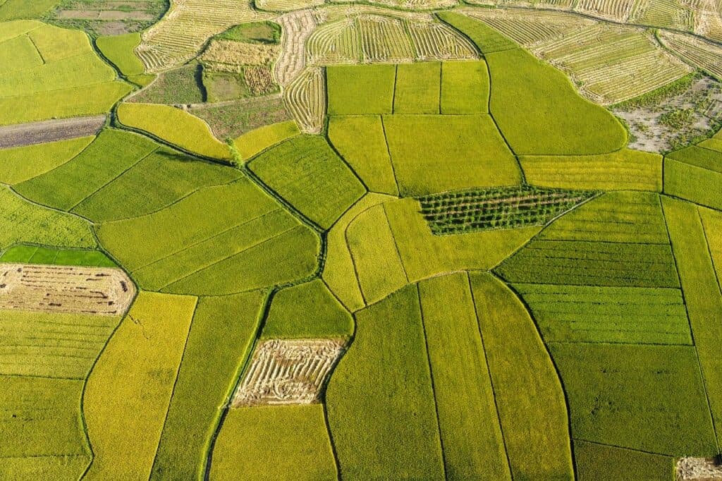
Precision Farming: GIS helps farmers make data-driven decisions by providing detailed maps and spatial analysis. By understanding soil variations, crop health, and weather patterns at a granular level, farmers can optimize planting, irrigation, and fertilization processes. This precision farming minimizes resource wastage and maximizes yields.
Crop Monitoring: With GIS, farmers can monitor crop growth and health in real-time. By using remote sensing technologies like satellites and drones, GIS can capture high-resolution imagery to detect early signs of diseases, pest infestations, or nutrient deficiencies. This timely information enables farmers to take corrective actions, preventing crop losses.
Land Management: GIS aids in land management by helping farmers assess the suitability of different areas for specific crops. It considers factors like soil type, drainage, and elevation, allowing farmers to make informed decisions about land use and crop rotation.
Resource Efficiency: Efficient resource management is crucial for sustainable agriculture. GIS can optimize water usage by providing insights into soil moisture levels, weather forecasts, and crop water requirements. This leads to reduced water wastage and increased crop quality.
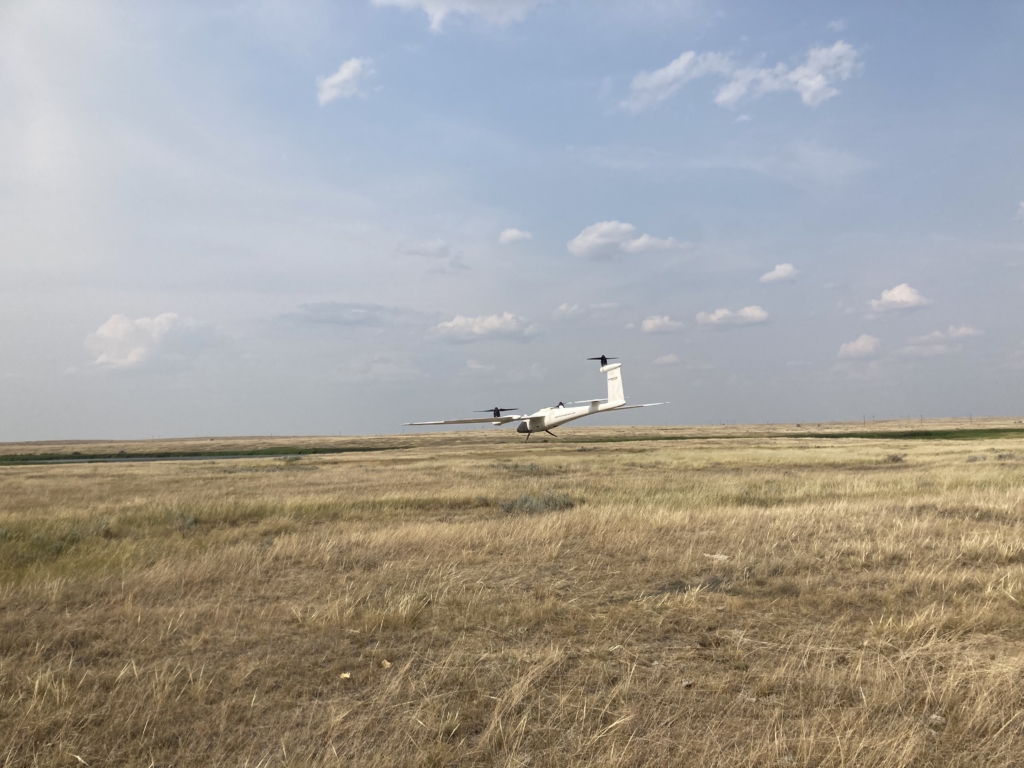
Drones, or Unmanned Aerial Vehicles (UAVs), have become indispensable tools in modern agriculture.
They offer a bird’s-eye view of farmland and can collect various types of data efficiently:
Aerial Imaging: Drones equipped with high-resolution cameras can capture detailed aerial imagery of fields. This imagery can be used for crop health assessment, identifying problem areas, and creating precise field maps.
NDVI Mapping: Normalized Difference Vegetation Index (NDVI) is a vital tool in agriculture. Drones can capture multispectral images that help calculate NDVI values, providing insights into crop health, stress, and growth patterns.
Pest and Disease Detection: Drones can be equipped with thermal cameras and sensors to detect variations in crop temperature, which can indicate the presence of pests or diseases. Early detection allows farmers to target treatments effectively.
Crop Spraying: Some drones are designed to carry and dispense fertilizers, pesticides, or herbicides. They can precisely apply these chemicals to specific areas, reducing chemical usage and environmental impact.
Data Collection: Drones can collect data on various aspects of farming, including soil moisture levels, plant counts, and canopy coverage. This data is invaluable for decision-making and optimizing farming practices.
Integration for Maximum Impact
By combining GIS with drone-collected data, farmers can create highly detailed maps and models that provide a comprehensive view of their fields. This synergy enables them to make precise decisions about planting, harvesting, and resource allocation.
For example, a farmer can use GIS to identify areas of a field with low soil fertility. Drones can then be deployed to capture multispectral images, which can confirm nutrient deficiencies. With this information, the farmer can apply fertilizers only where needed, reducing costs and minimizing environmental impact.
Challenges and Future Prospects
While GIS and drones offer numerous benefits, their adoption in agriculture does come with challenges. Initial investment costs, data management, and the need for specialized training are among the hurdles that need to be overcome.
However, as technology continues to advance and becomes more accessible, these challenges are gradually being addressed. In the near future, we can expect to see even greater integration of GIS and drone technologies in agriculture, leading to increased sustainability, efficiency, and productivity.
Conclusion
GIS and drones provide farmers with the tools to make informed, data-driven decisions. From precision farming to resource management, these technologies are helping farmers optimize their operations, reduce environmental impact, and increase yields.