About Us
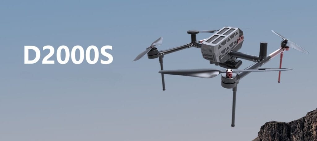
D2000S-A Compact Powerhouse for Varied Applications
One-stop, Premium-precision Aerial Surveying Solution Leveraged By High-end Multirotor Uav Platform
The D2000S drone system stands out as a small yet enduring multi-rotor marvel, crafted for high-precision mapping, remote sensing, and video applications. This aviation-enabled system boasts a comprehensive range of multi-source data acquisition capabilities, making it a versatile choice for diverse tasks.
Modular Efficiency and Portability
With a standard starting weight of 2.8kg, a 200g load capacity, and an impressive 74-minute battery life, the D2000S has been ingeniously modularized for seamless integration into a portable work box. This design ensures easy transport and quick deployment, catering to professionals on the move.
Tailored Mission Payload
The mission payload of the D2000S adopts a modular design, featuring an aerial survey module, tilt module, and thermal infrared remote sensing module. This tailored payload empowers the drone to excel in applications ranging from aerial surveys to true 3D modeling and remote sensing monitoring.
Advanced Video Capabilities
Equipped with video application modules boasting long-distance high-definition image transmission, the D2000S enables advanced functionalities such as target recognition, positioning, real-time tracking, and speed estimation.
Precise Positioning and Navigation
The D2000S is equipped with high-precision differential GNSS boards and dual differential antennas, offering standard features like network RTK, PPK, and fusion solution services. This ensures accurate 3D route planning, real-time monitoring, and reliable control point measurement.
Intuitive Software Solutions
Bundled with the “Unmanned Aircraft Manager Professional Edition (Measuring Edition)” software, the D2000S provides various route modes to meet diverse application requirements. This software supports accurate 3D route planning, real-time monitoring, GPS fusion solution, control point measurement, Aerial 3D solution, one-key mapping, and one-key exporting stereograms.
Comprehensive Data Processing
The system includes a free image control application and offers outputs such as DOM, DEM, DSM, TDOM, and more. This ensures comprehensive data processing and browsing capabilities, making the D2000S a reliable choice for professionals in need of precision and efficiency.
| System Weight | 2.6kg |
| Max Flight Weight | 3.8kg/2.8kg |
| Max load Weight | 1.2kg |
| Rotor Motor Size | 598mm |
| Size(Rotors) | Open 495mm*422mm*279mm |
| Satellites | GPS, BeiDou, Glonass |
| Power source | Electrical |
| Max speed | 20m/s |
| Max cuise speed | 13.5m/s up to 50km |
| Flight time | 7.0m/s(70 min of flight) |
| Hover time | 60min(single camera at sea level) |
| Max climb speed | 8m/s manual, 5m/s auto |
| Max descent speed | 5m/s manual, 3m/s auto |
| Hover accuracy RTK | HZ 1CM+1PPM VT2CM+1PPM |
| GPS update frequency | 20hz |
| Maximum starting altitude | 6000m |
| wind resistance | L6 (10.8~13.8M/S) |
| Control radius | up to 20km |
| take off mode | vertical automatic take off |
| operating temperature | -20-45 degree |