
In the realm of firefighting, employing drones for monitoring and mapping has the potential to significantly enhance safety and operational efficiency.
This technology offers real-time insights into the fire’s dimensions, structure, and surroundings, along with valuable information on air quality and wildlife.
Monitoring and Surveillance:
Drones, equipped with high-resolution cameras and infrared sensors, play a crucial role in monitoring large wildfire-affected areas. By capturing real-time data and imagery, authorities can assess the fire’s extent, identify hotspots, and plan firefighting strategies more effectively. For instance, infrared cameras on drones enable operators to see through smoke, allowing for efficient monitoring of fire behavior from a safe distance. This capability helps detect spotfires or escapes promptly, facilitating a quicker response without endangering crew members.
Source: Oklahoma State University Extension
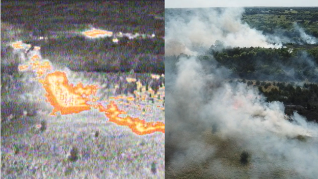
Figure 1. The Infrared camera allows the operator so see through smoke to monitor fire behavior. The same fire viewed with two different cameras, conventional RGB camera (right) and infrared (left).
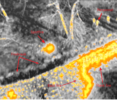
Figure 2. Infrared images are clear enough to identify spotfires, firebreaks, personnel, and fire types.
Early Detection:
Drones equipped with specialized sensors contribute to the early detection of wildfires. These sensors can identify signs of fire, smoke, or unusual heat patterns in remote areas. As technology advances, computer vision algorithms utilizing visual and infrared sensors become increasingly effective in remotely detecting forest fires, surpassing the limitations of traditional satellite imagery in terms of spatial and temporal resolution.
Relative paper reference: Forest fire flame and smoke detection from UAV-captured images
Communication and Coordination:
Drones serve as a valuable tool for enhancing communication among firefighting teams. Providing a bird’s-eye view of the situation, drones assist ground teams in making informed decisions about resource allocation and strategy. This improved communication aids in directing crews safely around burn units, keeping track of personnel and equipment placement.
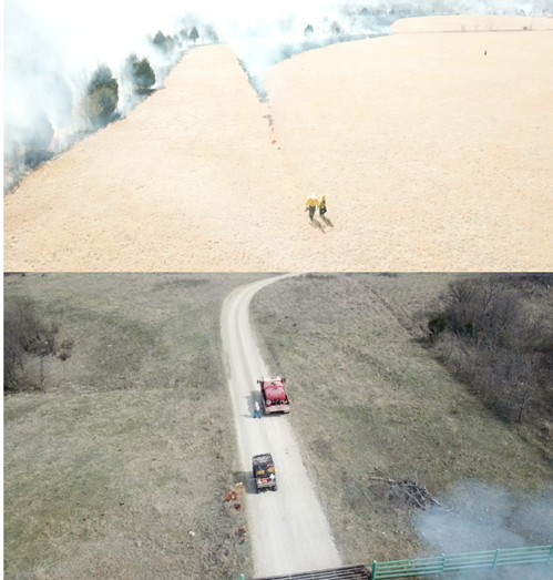
Figure 3. UAV use helps to keep track of personnel and equipment placement, then the controller can radio the crew to help direct them safely around the burn unit.
Mapping and Modeling:
Utilizing drones for mapping and modeling wildfire-affected areas results in detailed maps crucial for understanding terrain, predicting fire behavior, and planning evacuation routes. Remote sensing systems, particularly space-based multispectral sensors, offer biophysical measurements for various applications in fire ecology research, including fire risk mapping, fuel mapping, active fire detection, burn severity assessment, and monitoring vegetation recovery.
Relative paper reference: A Review of the Applications of Remote Sensing in Fire Ecology