We innovate, help and support agriculture
At AUAV, we’re committed to help the agriculture industry through drone technology.
Farmers across the world are increasingly turning to drones to optimize their crop management practices. To provide you with the insights you need, we’ve gathered answers to six of the most common questions about using drones in agriculture.
1. How high should I fly, and what overlap should I use?
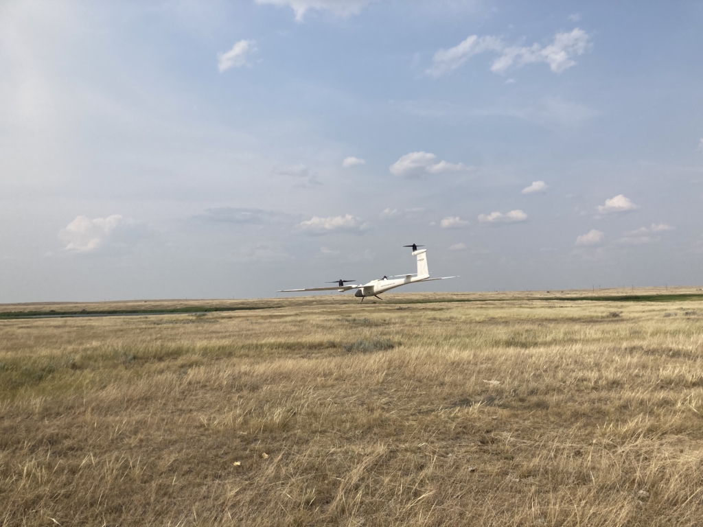
Determining the ideal flight altitude and overlap settings is crucial for successful crop monitoring. While there’s no one-size-fits-all formula, understanding the impact of flight altitude and overlap on map quality is essential. Higher altitudes cover more ground in less time with lower battery consumption. However, it sacrifices image resolution. For mature crops, lower resolution may suffice, but for emerging plants, consider flying lower (around 150–200 feet). Start with a 65% overlap, but feel free to adjust based on your specific needs.
2. How can I efficiently map larger areas and fly offline?
Mapping extensive fields in remote areas with poor connectivity is a common challenge. AUAV offers practical solutions. One of the core technological developments for our product is to establish both a 4G and radio connection between the operator and the UAV. This development allows for a larger and more stable connection, regardless of the region being urban or rural.
3. How do I access and interpret plant health data with AUAV drones, and do I need a special camera?
Monitoring plant health is critical for crop management. Our AUAV drones support NDVI (Normalized Difference Vegetation Index) maps, typically generated using NIR (Near Infrared) cameras. NDVI highlights variations in plant health effectively. However, we also accommodate the VARI index, designed for RGB (Red Green Blue) cameras. Ensure you select the correct filter type when applying NDVI with AUAV to match your camera’s specifications.
1. How high should I fly, and what overlap should I use?
Determining the ideal flight altitude and overlap settings is crucial for successful crop monitoring. While there’s no one-size-fits-all formula, understanding the impact of flight altitude and overlap on map quality is essential. Higher altitudes cover more ground in less time with lower battery consumption. However, it sacrifices image resolution. For mature crops, lower resolution may suffice, but for emerging plants, consider flying lower (around 150–200 feet). Start with a 65% overlap, but feel free to adjust based on your specific needs.
4. How can I export my maps from AuAV drones for comparison with yield maps, soil maps, and other data?
To gain comprehensive insights into crop health and yield potential, integrate your AuAV drone maps with other datasets like soil sample data and historical yield maps. AUAV streamlines map export in various formats. Customize the export to align with your specific needs, such as selecting the appropriate resolution for compatibility with precision agriculture software.
1. How high should I fly, and what overlap should I use?
Determining the ideal flight altitude and overlap settings is crucial for successful crop monitoring. While there’s no one-size-fits-all formula, understanding the impact of flight altitude and overlap on map quality is essential. Higher altitudes cover more ground in less time with lower battery consumption. However, it sacrifices image resolution. For mature crops, lower resolution may suffice, but for emerging plants, consider flying lower (around 150–200 feet). Start with a 65% overlap, but feel free to adjust based on your specific needs.
5. Where can I find additional resources and support for AUAV drones?
AuAV is committed to providing comprehensive support. Explore our extensive Help Center, featuring guidance on successful map stitching and agriculture-specific best practices. Additionally, our team is readily available to assist you. Connect with local agricultural experts and experienced drone operators for valuable insights and guidance tailored to your region.
1. How high should I fly, and what overlap should I use?
Determining the ideal flight altitude and overlap settings is crucial for successful crop monitoring. While there’s no one-size-fits-all formula, understanding the impact of flight altitude and overlap on map quality is essential. Higher altitudes cover more ground in less time with lower battery consumption. However, it sacrifices image resolution. For mature crops, lower resolution may suffice, but for emerging plants, consider flying lower (around 150–200 feet). Start with a 65% overlap, but feel free to adjust based on your specific needs.
6. Which AUAV plan suits my specific agricultural needs?
Selecting the right AUAV plan is essential for optimizing your agricultural operations. Explore our range of plans and their features to determine the one that best aligns with your unique requirements and usage frequency.
In conclusion, AUAV drones are transforming modern agriculture, offering farmers invaluable insights and operational efficiencies. By addressing these common questions, we aim to equip growers with the knowledge and tools they need to harness the full potential of AUAV technology in their farming practices. Stay informed about the latest developments and best practices to remain at the forefront of agricultural technology. AUAV is your partner in the future of farming.